更新日:2025年12月15日
ここから本文です。
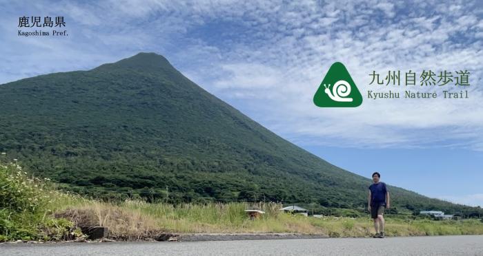
九州自然歩道(鹿児島県ルートマップ)について
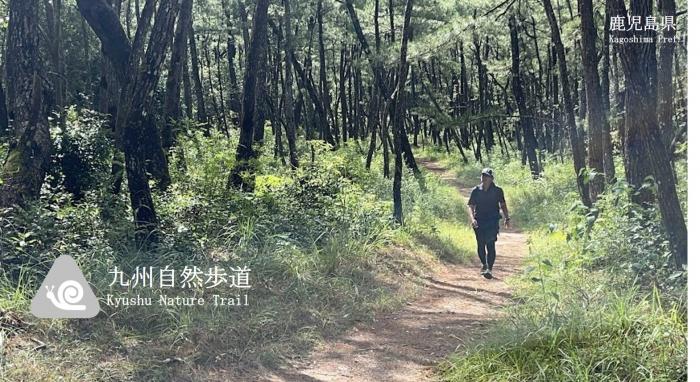
九州を一周するこの歩道は全長約2,932kmで,このうち鹿児島県の延長は約560kmです。
Kyushu Nature Trail is designed for visitors to walk slowly through Kyushu's National parks, Quasi-National Parks, Prefectural Natural Parks, mountainous areas, lakes, and other natural wonders, and to visit historical and cultural sites to help restore humanity, which is often lost, and to improve physical fitness. This trail, which circles Kyushu, is approximately 2,932 km long, of which Kagoshima Prefecture extends approximately 560 km.
【イベント / Event】
『歩き育てる、九州自然歩道鹿児島セッション~ぐるいとさるっもんそ~』
日時:令和7年10月4日(土曜日)13時15分~17時00分
場所:サンプラザ天文館7階ホール(鹿児島市東千石町2-30)
主催:鹿児島県自然保護課,一般社団法人九州自然歩道フォーラム
プログラム・動画(当日の動画は右側のリンク又は二次元バーコードからご覧いただけます)
Part-1 九州自然歩道って実際に歩けるの?楽しいの? Part-1動画
・九州自然歩道って何のためにどうやって作られたの?:10分
福島 優(九州自然歩道フォーラム 代表)
・九州自然歩道の鹿児島ルートは歩けるの?楽しいの?:各15分
3人のハイカー(相良 望人/秋田 修/内藤 徹)
聞き手:土屋 智哉(ハイカーズデポ 代表)
・トレイル団体PRピッチ:10分
Part-2 歩くと何が良いの?歩く道があると地域はどうなるの? Part-2動画
・トークセッション1~歩くと体と心が変わる・生き方が変わる・地域が変わる~:60分
池田 光史(NewsPicks 上席執行役員)
臼井 香苗(JTB総合研究所ヘルスツーリズム研究所 主任研究員)
田川 光介(九州自然歩道フォーラム 長崎支部長)
聞き手:相澤 久美(みちのくトレイルクラブ 事務局長)
Part-3 もっと盛り上げるためにハイカーや沿線施設・地域はどうしたらいいの?
・鹿児島県の取組:10分
川瀨 翼(鹿児島県自然保護課長) Part-3動画
・トークセッション2~九州自然歩道への期待~:45分
土屋 智哉(ハイカーズデポ 代表)
野元 尚巳(九州自然歩道フォーラム 事務局長)
福島 優(九州自然歩道フォーラム 代表)
聞き手:相澤 久美(みちのくトレイルクラブ 事務局長)
【マップ/Map】
<Google Map>
九州自然歩道のルートは下記ページから閲覧・保存が可能です
https://www.google.com/maps/d/viewer立方メートルmid=1BeFUvtYuXgCvVhcybhw7M_8sGp1AIXvw&ll=32.43897406026531%2C130.11167149999994&z=7(外部サイトへリンク)
<Route Map>
00九州自然歩道(県全体)(PDF:240KB)
01九州自然歩道(霧島市)(PDF:983KB)
02九州自然歩道(鹿屋市・垂水市)(PDF:969KB)
03九州自然歩道(錦江町)(PDF:459KB)
04九州自然歩道(南大隅町)(PDF:303KB)
05九州自然歩道(指宿市)(PDF:352KB)
06九州自然歩道(南九州市)(PDF:473KB)
07九州自然歩道(枕崎市)(PDF:420KB)
08九州自然歩道(南さつま市)(PDF:781KB)
09九州自然歩道(日置市)(PDF:484KB)
10九州自然歩道(いちき串木野市)(PDF:543KB)
11九州自然歩道(薩摩川内市)(PDF:621KB)
12九州自然歩道(さつま町)(PDF:597KB)
13九州自然歩道(伊佐市)(PDF:523KB)
【通行止め・迂回路情報 / Road Closure and Detour Route Information】
(1)霧島市亀割峠~垂水市大野 Kamewari Pass, Kirishima City ~ Ono, Tarumizu City
ルート地図(霧島市亀割峠~垂水市大野)(PDF:369KB)
最新情報は霧島市HP,県HP等からご確認ください
https://www.city-kirishima.jp/doboku/machizukuri/doro/kotsukise/oshirase.html
https://www2.pref.kagoshima.jp/dourokisei/Index
(2)辻岳~根占横別府大久保(林道根占中央線)Forest roads between Mt.Tsuji and Nejime-Yokobeppu-Okubo, Minami-osumi town
ルート地図(辻岳~根占横別府大久保(林道根占中央線))(PDF:411KB)
最新情報は南大隅町HPからご確認ください
https://www.town.minamiosumi.lg.jp/kensetsu/douro/dourojyouhou.html
【関連サイト/ Links】
環境省「国立公園に,行ってみよう!」九州自然歩道ページ
https://www.env.go.jp/nature/nationalparks/pick-up/long-trail/kyushu/
・九州自然歩道フォーラム
https://kntf.jp/
よくあるご質問
このページに関するお問い合わせ
より良いウェブサイトにするためにみなさまのご意見をお聞かせください